|
May 20-June 2, 2002 Santa Catalina Mountains Coronado National Forest . . Tucson Arizona |
|
The following Bullock Fire progression maps are based on USGS 30-m DEMs, 7.5-min DRGs, and forest service fire maps available online during the fire. 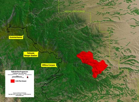 May 20, 2002 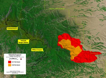 May 21, 2002 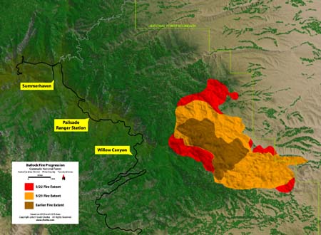 May 22, 2002 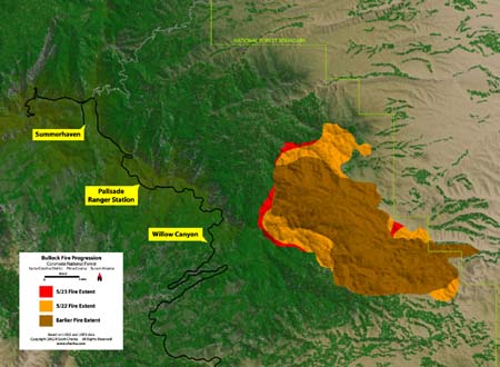 May 23, 2002 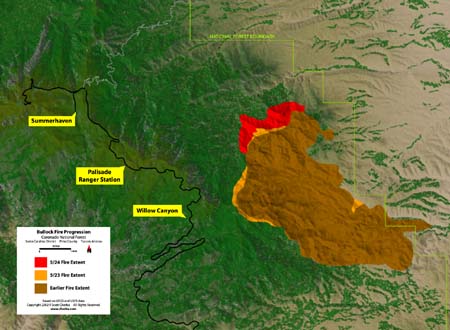 May 24, 2002 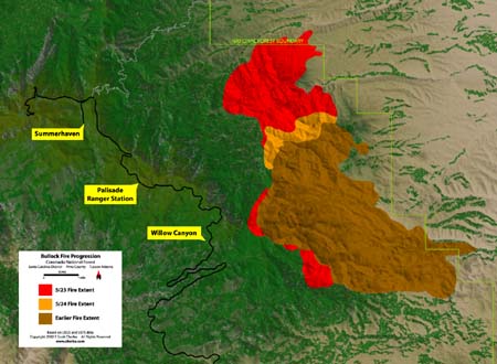 May 25, 2002 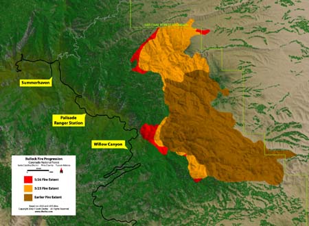 May 26, 2002 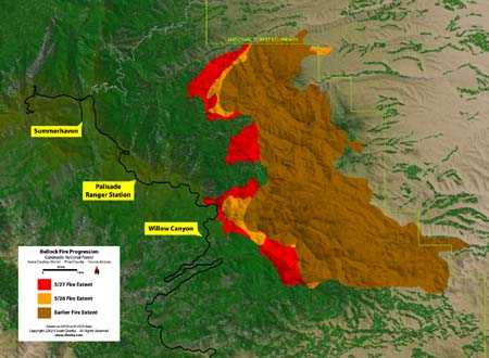 May 27, 2002 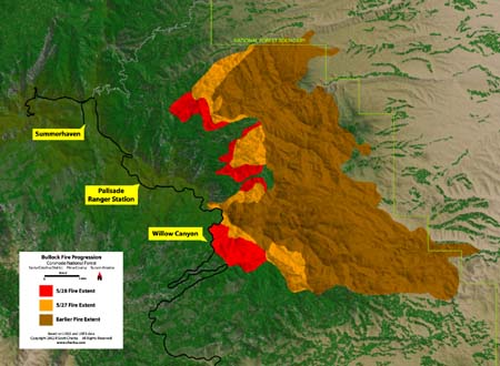 May 28, 2002 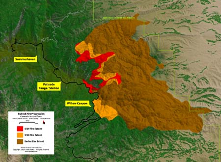 May 29, 2002 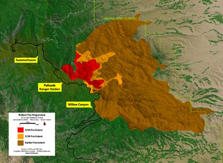 May 30, 2002 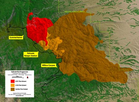 May 31, 2002 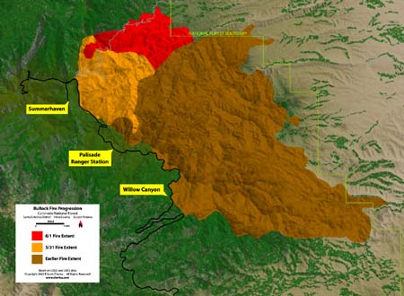 June 1, 2002 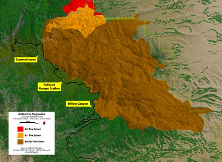 June 2, 2002 |
|
About the maps. Digital terrain was created in 3D Nature's Visual Nature Studio (VNS) from USGS 30-m DEMs. USGS 7.5-min DRG foliage zones were separated from all else in Photoshop and used to drive ecosystem placement in VNS. The Bullock Fire progression maps by Humphrey's Southwest Incident Management Team were used to create a sequence of color maps in Adobe Illustrator to place fire zones in VNS. Final map assembly was done in Illustrator. |
Copyright 2002 R Scott Cherba