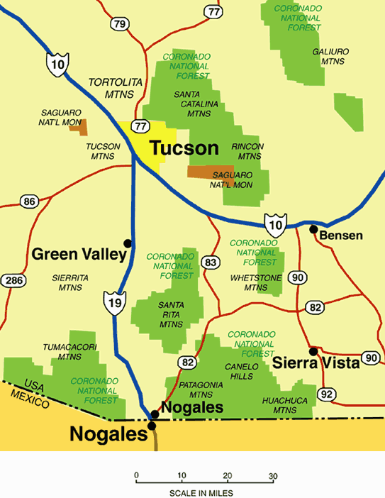
Are you looking for rides that use more than granny gear and exceed 2 miles per hour? How about a relaxing ride in the country the whole family can enjoy without cursing you? Arizona has with more than its fair share of public land just waiting for you. National Forests, State Parks, Bureau of Land Management (BLM) land, and recreational areas offer plenty of open space for those weary of concrete and rush hour traffic. Most of these areas are within an hour or two of Tucson and make great day or weekend recreational rides. Just get a good map, pack your cooler, picnic basket, and spare clothes, and start driving. Stop when you get to a place that looks good to ride. For the adventurous who 'don't need no stinkin guide', all you need is a Forest Service map and camping gear and you can explore hundreds of miles of dirt roads from a base camp. Campgrounds are available or you can just pick a spot in National Forest and set up your tent. A Word on Maps Topographic maps are nice to have, but can be difficult to carry while riding. They may not be marked with forest road numbers, which make them harder to use when following forest service roads. National Forest maps lack contour lines but show drainages, peaks, and most importantly, forest roads by number. They come folded and usually one map covers the area you're riding. For riding forest roads in southern Arizona, I recommend National Forest Service maps. A good companion to help you get to where you're riding is DeLorme Mapping's Arizona Atlas & Gazetteer. One oversized softcover book has DeLorme's version of topographic maps for the state. The scale isn't detailed enough to ride by, but it's usually enough to get you to the trailhead. The DeLorme Atlas has one major disadvantage for those who like to use GPS to confirm their location. Maps are only marked in latitude and longitude and not the more useful UTM grid in the revisions I've used. Tucson Map & Flag stocks forest service and topo maps. Forest service maps (usually 6$-7$) and free information is also available at Coronado National Forest Ranger Stations. Tucson Map & Flag Center
Molino-Bellota Loop. This is not one for the whole family, but it will put some miles behind you. Park at the intersection of Tanque Verde Road and Catalina Highway for a challenging 30-mile loop. Ride up the Catalina Highway to Molino Basin, follow the Arizona Trail to Bellota Ranch Road south, and follow Redington Road west to your starting point. Watch out for the technical climb and descent between Molino Basin and West Spring. Mt. Lemmon Fire Control Road. Yet another 'not for the weak of heart' kind of abuse. Drive around the west end of the Santa Catalinas to Oracle. American Avenue through Oracle becomes Mt. Lemmon Road (FR 38). A good starting place is the campground at Peppersauce Wash. 25 miles or so of riding up the mountain will take you to the Catalina Highway near Summerhaven. Then it's just a log way down. Ride anytime but summer.
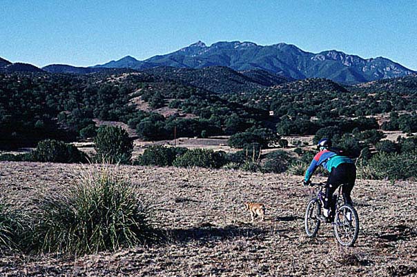
Redington Road (Forest Road 371) follows Tanque Verde Canyon between the Rincon and Santa Catalina Mountains. It tops a pass between the two ranges before dropping down into the San Pedro Valley. Tanque Verde Falls is a popular destination so the road is well traveled for the first 8-10 miles. Once you get a few miles past the falls you'll have the road to yourself. Winter offers the best daytime temperatures. Lower elevations are not recommended for summer riding, unless you like 100 F plus days without shade or wind. Happy Valley. Along the east flank of the Rincon Mountains, FR 35 follows Ash Creek into Happy Valley. The forest road can be reached north of Interstate 10 (Exit 297). The road climbs a pass and drops down into the San Pedro Valley, eventually ending up at the town of Redington. This is another quiet section of road that sees little traffic. The best time to ride is anytime but summer.
Saguaro National Park West. The park offers gentle hills and lots of saguaro cactus. Follow Speedway Boulevard west of town up and over the Tucson Mountains. Turn right on Kinney Road when you 'T' into it. Keep going until you reach the well marked park turnoff. The park has a scenic dirt road that you can take out and back. To make a loop, start on pavement by riding north and east around the park on Palo Verde Trail and Picture Rocks Road. Then it's a gradual downhill on Golden Gate Road to the visitor center.
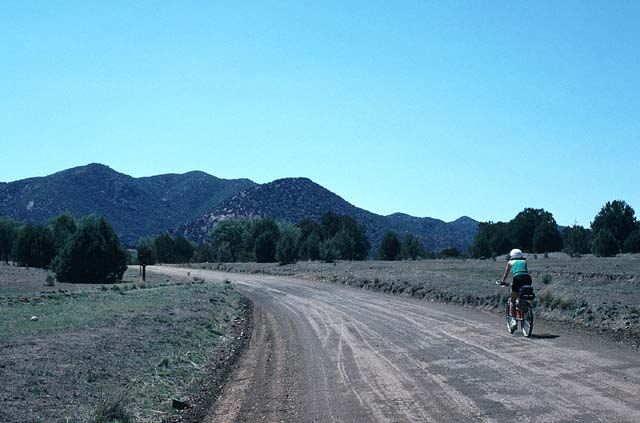
Gardner Canyon. This is a great place to set up camp and ride the forest roads. Follow Highway 83 approximately 21 miles south of I10 and turn right on Gardner Canyon Road (FR 92). Follow the road at least 6 miles and look for a comfortable camping spot. On the way make a mental note of the Arizona Trail trailhead in case you want to try it (highly recommended). From base camp, pull out your map and start riding. As long as you have a forest service map, it's hard to get lost with all the road signs posted. Empire-Cienega. When you get tired of trees check out the Empire-Cienega Recreational Area on the east side of Highway 83 a few miles north of Gardner Canyon Road. Miles of rolling grassland and cattle await you. If you follow the dirt road long enough (25-30 miles), the road will drop you off on Highway 82 east of Sonoita.
This is a another great place to set up camp and ride the forest roads. It's less traveled and offers smooth riding when you need a break from the rocky technical trails. Look for Harshaw Road east of Highway 82 in Patagonia. It will take you up and into the Patagonia Mountains. Explore.
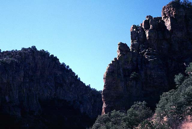
Ruby Road. Watch for the Ruby Road turnoff (Exit 12) 8 miles north of Nogales on I19. Follow Ruby Road west to Pena Blanca Lake, where it turns into dirt and adds FR 39 to its name. There's a campground at the lake if you prefer facilities, or you can follow any side road off FR 39 for a more private and primitive spot. Ruby Road continues about 25 miles to Arivaca. This is a good area to explore if you like ghost towns. On the road to Arivaca you'll pass what's left of Ruby, Oro Blanco, and several abandoned mining camps. Arivaca itself is billed as a ghost town even though people still live there. Sycamore Canyon. Ruby Road crosses Sycamore Canyon 7-8 miles west of Pena Blanca Lake. You should see a marked parking area on the left side of the road. This is a very scenic hike in the spring if you're looking for a break from the saddle. No bikes allowed. The half-day hike follows the canyon into the Pajarita Wilderness.
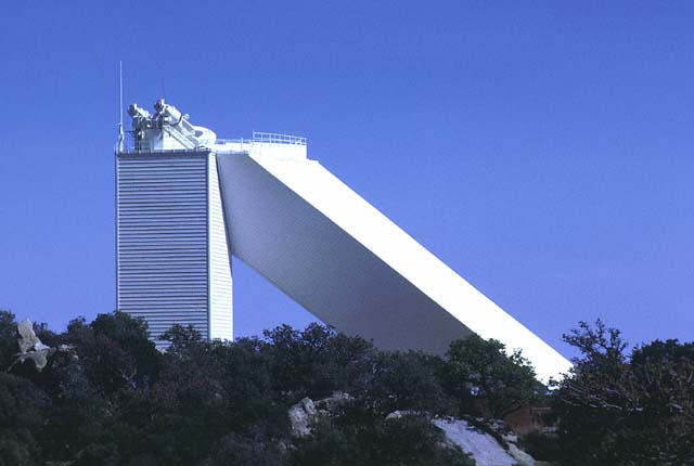
Do you like hills with great views from the top? Kitt Peak crowns the north end of the Baboquivari Mountains, about 40 miles west of Tucson off Highway 86. You can't miss it. If you don't mind riding blacktop, this is one of the best roads you'll find. The road is 12 miles long, in good condition, wide, and isn't open to visitor motor traffic until 10 am. There is also a jeep trail that climbs on the east side of the highway, but I haven't followed it to the top. Kitt Peak offers 360 degree views of southern Arizona and an excellent visitor center. Don't forget your windbreaker. There's usually a chilly wind blowing.
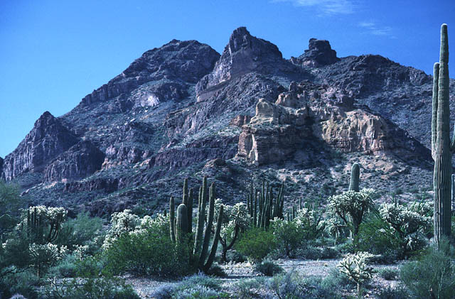
Follow Highway 86 west to Why. Turn south on Highway 85 and follow it to the monument. On the east side of the highway, Ajo Mountain Drive is a 21-mile one-way dirt road loop that takes you up through the Diablo Mountains and along the Ajo Range. In the west, Puerto Blanco Drive is a 53-mile one-way dirt road loop that encloses the Puerto Blanco Mountains and crosses the La Abra Plain. It passes Quitobaquito Springs, an unusual spring-fed oasis in the desert. Both loops cross very scenic desert. These are definitely not summer rides. No water is available along either road. A small campground is available near the visitor center. |
|
|
|

Copyright 1997-2005 R Scott Cherba All Rights Reserved