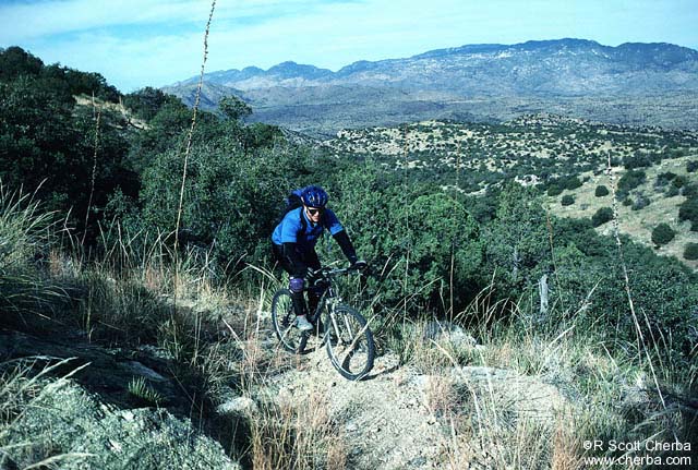
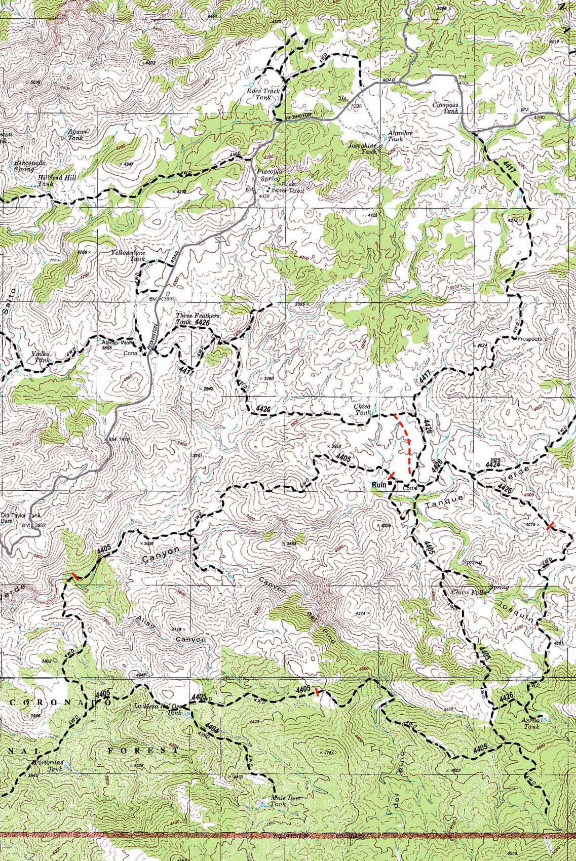
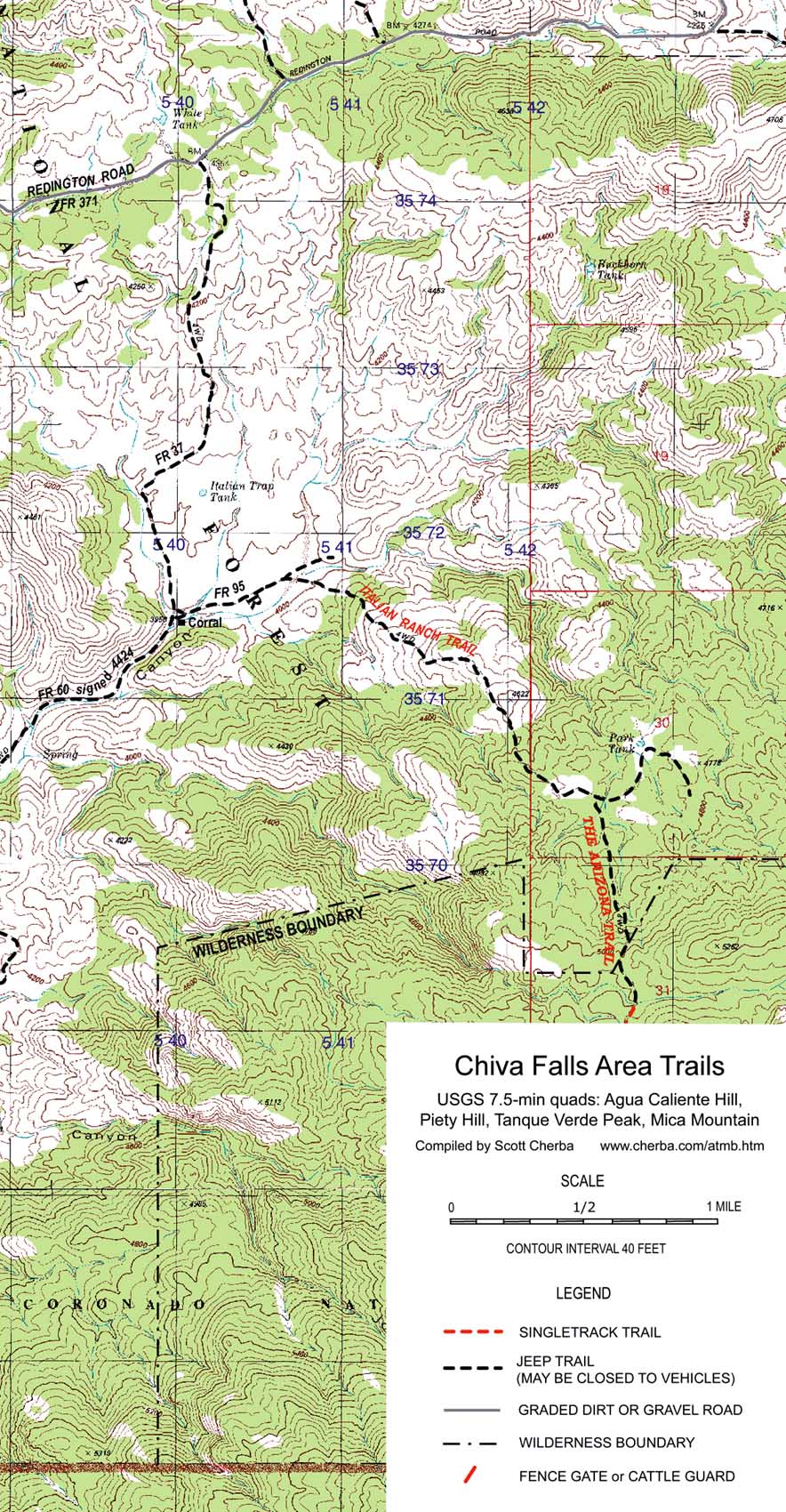
Description This trail follows part of the Rincons Mountains Passage section of the Arizona Trail. You may also find the Italian Ranch Trail named the Italian Spring Trail in some references. You'll have a gently climbing warmup before turning off on a jeep trail for a rolling descent to the Tanque Verde Wash. The trail offers scenic vistas of the desert valley below the Rincon Mountains, especially in the early morning. Once you cross the wash the climbing fun starts. And the trail keeps climbing to the top of Mica Mountain. Unfortunately, you can only ride as far as the wilderness boundary. There you'll find shade and a stream to rest by before the return trip. You'll be rewarded with more high altitude views of the Santa Catalina Mountains. Hikers are encouraged to continue into the Saguaro Wilderness. Rating If you've cruised the easy Chiva trails and are looking for something more challenging, this is a good ride to try. It's a shorter version of the High Chiva Loop. The first 3.5 miles is a fun and easy (mostly) downhill ride. Once you cross the Tanque Verde Wash, Italian Ranch Trail quickly becomes 2.5 miles of steep uphill climbing. Compared to the upper loop, this trail covers more elevation in a shorter distance. The good news is that you can turn around when you've had enough. How to get there Take Tanque Verde Road east of town where it turns into Redington Road. Follow Redington Road 8 miles after the paved road ends and the dirt road starts. Park at the small clearing on the right with a jeep trail. This is the second entrance to Chiva Falls. 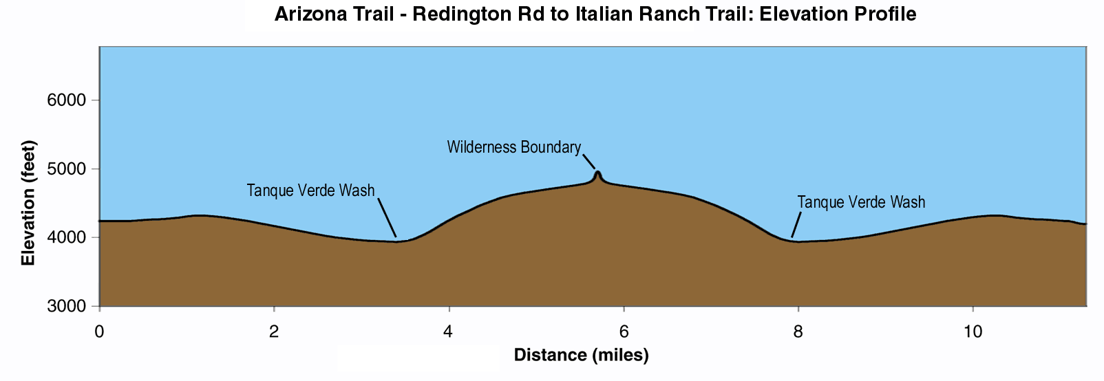 Trail Log
Notes Start early to avoid traffic on the trail. This access doesn't see much use but the Chiva Falls area is probably the busiest around. It's also very popular with 4WD and quad enthusiasts. You'll find the vehicles noisy but the riders friendly and helpful. More than once we've been offered food, water, and a ride. Watch out for hikers and horses and yield the trail, smile, and wave. They're not common but that's all the more reason to watch for them. Trail maps are not complete. 4WDs are adding trails even as we speak so not all of them are mapped. Most of the important intersections still have trail markers. |
|
|
|

Copyright 1997-2004 R Scott Cherba All Rights Reserved